
River Walk at Mud Island
At the conclusion to our Walking Tour of downtown Memphis, we will take a one of a kind tour of the Mississippi River at the Mud Island River Walk and Museum. The "River Walk" is a scale model of the Mississippi River, located on Mud Island, a small man made island connected to Memphis by a monorail and a driving bridge. The River Walk is a permanent exhibit modeling the Lower Mississippi River from its confluence with the Ohio River at Cairo, Illinois to the Gulf of Mexico. The model features twenty scale maps of river cities, four watershed panels showing the river's major tributaries; concrete wedges illustrating smaller tributaries; naturally occurring river features, such as sandbars; engineering structures and bridges; and 68 free standing text panels that detail particular locations on the river. In the "Gulf of Mexico", visitors can even rent pedal boats!
Mississippi River Museum
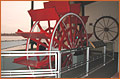
We will spend the first couple of hours in the Mississippi River Museum. Although not necessarily of geological significance, the 18 galleries of exhibits in the museum give visitors a view of the importance of the river to people of past and present cultures. Included in the museum are exhibits depicting life on a riverboat during the 1870's, battles of the Civil War and the music of the river from blues and jazz to the rock 'n' roll of Elvis Presley. After our tour of the Mississippi River Museum, we will have lunch in one of the restaurants located on the grounds of Mud Island. We will also have a little time for shopping!

Mississippi Watershed
Finally, we will take a walk along the River Walk. This walk will give us an excellent opportunity to discuss and actually visualize, in miniature form, a variety of topics important to the study of geology of the area. Some of the discussion opportunities include, but are not limited to the following: watersheds, flood plains, oxbow lakes, meanders. We will have an opportunity to locate, geographically, New Madrid (the location of the famous earthquake of the 1800's) and Reelfoot Lake (the lake created by the earthquake). We will be physically visiting both of these places later in our trip.
Taking note of the number of cities located adjacent to the river will give us an excellent opportunity to discuss the importance of water quality and the environment. This will naturally lead to a discussion about the "Gulf of Mexico" and the so called "dead zone". An area of approximately 20,000 square kilometers within the Mississippi River Delta is "dead" to plant and animal life due to a excess in nutrients (nitrogen and phosphorous). These nutrients trigger an excessive growth of algae. Decomposition of this algae causes an extreme lowering of the dissolved oxygen, or "hypoxia" in the area. Finally, hypoxia leads to death of sea life, both plant and animal and the so called "dead zone". It is theorized that the excess nutrients are produced by industry, agriculture and people living in cities adjacent to the river and adjacent to rivers and streams that drain into the Mississippi River
Taking note of the number of cities located adjacent to the river will give us an excellent opportunity to discuss the importance of water quality and the environment. This will naturally lead to a discussion about the "Gulf of Mexico" and the so called "dead zone". An area of approximately 20,000 square kilometers within the Mississippi River Delta is "dead" to plant and animal life due to a excess in nutrients (nitrogen and phosphorous). These nutrients trigger an excessive growth of algae. Decomposition of this algae causes an extreme lowering of the dissolved oxygen, or "hypoxia" in the area. Finally, hypoxia leads to death of sea life, both plant and animal and the so called "dead zone". It is theorized that the excess nutrients are produced by industry, agriculture and people living in cities adjacent to the river and adjacent to rivers and streams that drain into the Mississippi River
Next site on the trip.